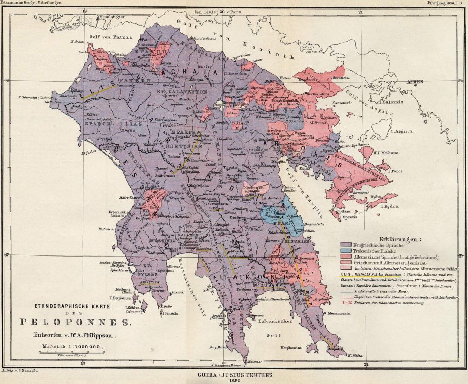
In this German map, the ethnic map of the Peloponnese was given as follows in 1890. Pink and shades show Christian Albanians. The lightest pink shade is the most assimilated Albanians. Yellow lines are already assimilated Slavic villages. This is the success between 1830-1890.

You see Athens in the white part of the map. Do not think that these parts are not Albanian. Since the map is related to MORA, they did not show the other parts. Watch out for the transition to a pure Christian Albanian majority as you approach Athens. Yes, Athens’ surroundings were full of them.

Here we see the invisible part of the map. Let’s look around Athens in this way. Christian Albanian villages and towns around Athens in the image.


